Download ArcGIS Desktop Associate 10.5.EADA105.VCEplus.2019-11-25.80q.vcex
| Vendor: | Esri |
| Exam Code: | EADA105 |
| Exam Name: | ArcGIS Desktop Associate 10.5 |
| Date: | Nov 25, 2019 |
| File Size: | 901 KB |
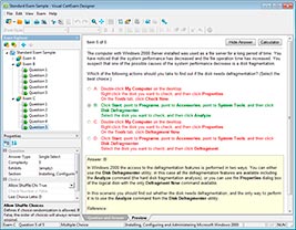
How to open VCEX files?
Files with VCEX extension can be opened by ProfExam Simulator.
Discount: 20%
Demo Questions
Question 1
A GIS analyst sets label properties for a feature class but wants to save the labels for use in other maps with the ability to edit the labels in ArcMap as needed.
What would the GIS analyst do to create and save the labels?
- Save the settings in a layer file
- Convert Labels to Map Annotation
- Convert Labels to Geodatabase Annotation
- Use the Maplex Label Engine
Correct answer: C
Explanation:
Reference: http://desktop.arcgis.com/en/arcmap/10.3/map/working-with-text/converting-labels-to-annotation.htm Reference: http://desktop.arcgis.com/en/arcmap/10.3/map/working-with-text/converting-labels-to-annotation.htm
Question 2
How should an analyst use the field calculator to concatenate fields "City_Name" and "Region" with a comma and a space between the values?
- !City_Name! + "," + !Region!
- !City_Name! + "" + !Region!
- !City_Name! + ",_" + !Region!
- !City_Name! + "+" + !Region!
Correct answer: A
Question 3
A company is migrating all external data to a new server, which causes the data paths of several layers in a map document to break.
How should the data paths of the broken layers be repaired most efficiently?
- Open the map document > Right-click each layer with a broken data source > Data > Repair data source
- Open the map document > Right-click each layer with a broken data source > Properties > Set data source
- Open ArcCatalog > Create new folder connection > Connect to data folder on new server
- Open ArcCatalog > Right-click the map document > Set Data Source(s)
Correct answer: A
Explanation:
Reference: http://desktop.arcgis.com/en/arcmap/10.3/map/working-with-layers/repairing-broken-data-links.htm Reference: http://desktop.arcgis.com/en/arcmap/10.3/map/working-with-layers/repairing-broken-data-links.htm
Question 4
An ArcGIS Online user is beginning to work on a project that will involve multiple organizations. Each organization has its own ArcGIS Online subscription. The project requires that only the project team have access to the data, and any team member should be able to contribute to the project.
Which sharing option should the user select?
- Everyone
- Organization
- Group
- Organization and Group
Correct answer: B
Question 5
What is the proper workflow to export only the attribute table of a feature class to a file geodatabase?
- Right-click the layer in the Contents pane > Data > Export Data
- Right-click the layer in the Contents pane > Data > Export Table
- Open the Table To Excel Tool > Use the feature class as the input > Run the tool
- Right-click the target geodatabase > Import > Feature class (single)
Correct answer: A
Explanation:
Reference: https://desktop.arcgis.com/en/arcmap/latest/manage-data/geodatabases/exporting-feature-datasets-classes-and-tables-to-a.htm Reference: https://desktop.arcgis.com/en/arcmap/latest/manage-data/geodatabases/exporting-feature-datasets-classes-and-tables-to-a.htm
Question 6
A GIS technician has a polygon layer of land use types and a separate table that contains the definition of each land use type. Several polygons have the same land use type.
How should the technician apply the land use type descriptions in the table to the polygon layer?
- Relationship Class
- Relate
- Join
- Spatial Join
Correct answer: A
Explanation:
Reference: http://desktop.arcgis.com/en/arcmap/10.3/manage-data/tables/about-joining-and-relating-tables.htm Reference: http://desktop.arcgis.com/en/arcmap/10.3/manage-data/tables/about-joining-and-relating-tables.htm
Question 7
An ArcGIS user is creating a new water distribution network. In the water pipe feature class, fire hydrant laterals must have a pressure between 40 and 100 psi. Service water pipes must have a pressure between 50 and 75 psi.
What must the user create to keep both pipe types in one feature class?
- Relationship Rules
- Coded Value Domain
- Connectivity Rules
- Subtypes
Correct answer: D
Explanation:
Reference: http://help.arcgis.com/en/arcgisdesktop/10.0/pdf/building-a-geodatabase-tutorial.pdf (09) Reference: http://help.arcgis.com/en/arcgisdesktop/10.0/pdf/building-a-geodatabase-tutorial.pdf (09)
Question 8
An ArcGIS user has returned from performing field data collection with a high accuracy GPS device. Upon importing the GPX files into ArcGIS as shapefiles, the user notices that some of the collected points are now coincident. The user knows that the points should display separately because they are two distinct features.
Which environment settings should be changed to make sure that the points are imported in millimeter precision?
- Output X,Y Domain
- X,Y Tolerance
- X,Y Resolution
- Coincident Points
Correct answer: A
Question 9
An editor has built map topology and needs to modify the shape of neighboring polygons.
Which tool would maintain the shared polygon boundaries?
- Reshape Edge Tool
- Trance
- Split Tool
- Reshape Feature Tool
Correct answer: D
Question 10
In a scene in ArcGIS Pro, a user finds that a streets layer draws elevated at a distance above the ground, instead of draped over the ground surface.
How should the user fix the problem and place the streets layer on the ground?
- Project tab > Options > Map and Scene tab
- Scene Properties > Elevation Surface tab
- Scene Properties > Coordinate Systems tab
- Layer Properties > Elevation tab
Correct answer: D
HOW TO OPEN VCE FILES
Use VCE Exam Simulator to open VCE files
HOW TO OPEN VCEX AND EXAM FILES
Use ProfExam Simulator to open VCEX and EXAM files
ProfExam at a 20% markdown
You have the opportunity to purchase ProfExam at a 20% reduced price
Get Now!